Construction Drones
Use Drones in Construction Industry
Achieve unprecedented project efficiency, precision, and safety with construction drones providing aerial geo-tagged drone images, videos & 360 images.
Get Started Now
Achieve unprecedented project efficiency, precision, and safety with construction drones providing aerial geo-tagged drone images, videos & 360 images.
Get Started Now
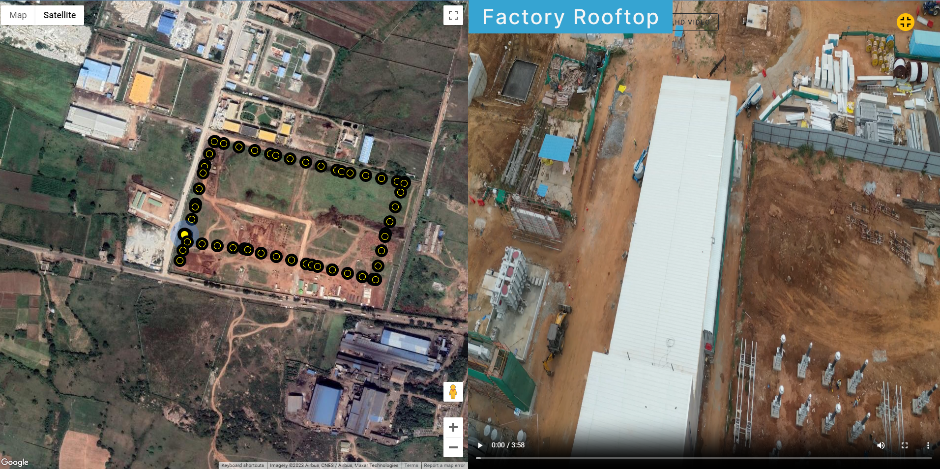
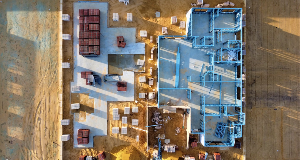
Construction drones provide geo-tagged drone imagery, videos, and 360-degree panoramic images through a web-based dashboard accessible from any device, anywhere. This ensures precise and efficient evaluation of construction project progress, facilitating team collaboration for quicker decision-making using visual aerial data.
Systematically evaluate the project's visual data and maintain a comprehensive record of all images and videos from inception to completion.
Access well-organized construction drone data securely with authorized login credentials, avoiding the usual method.
| Key Features
Experience peak efficiency with construction UAV's comprehensive set of features meticulously designed to elevate your project management, ensuring unparalleled performance and success in every project.
View Presentation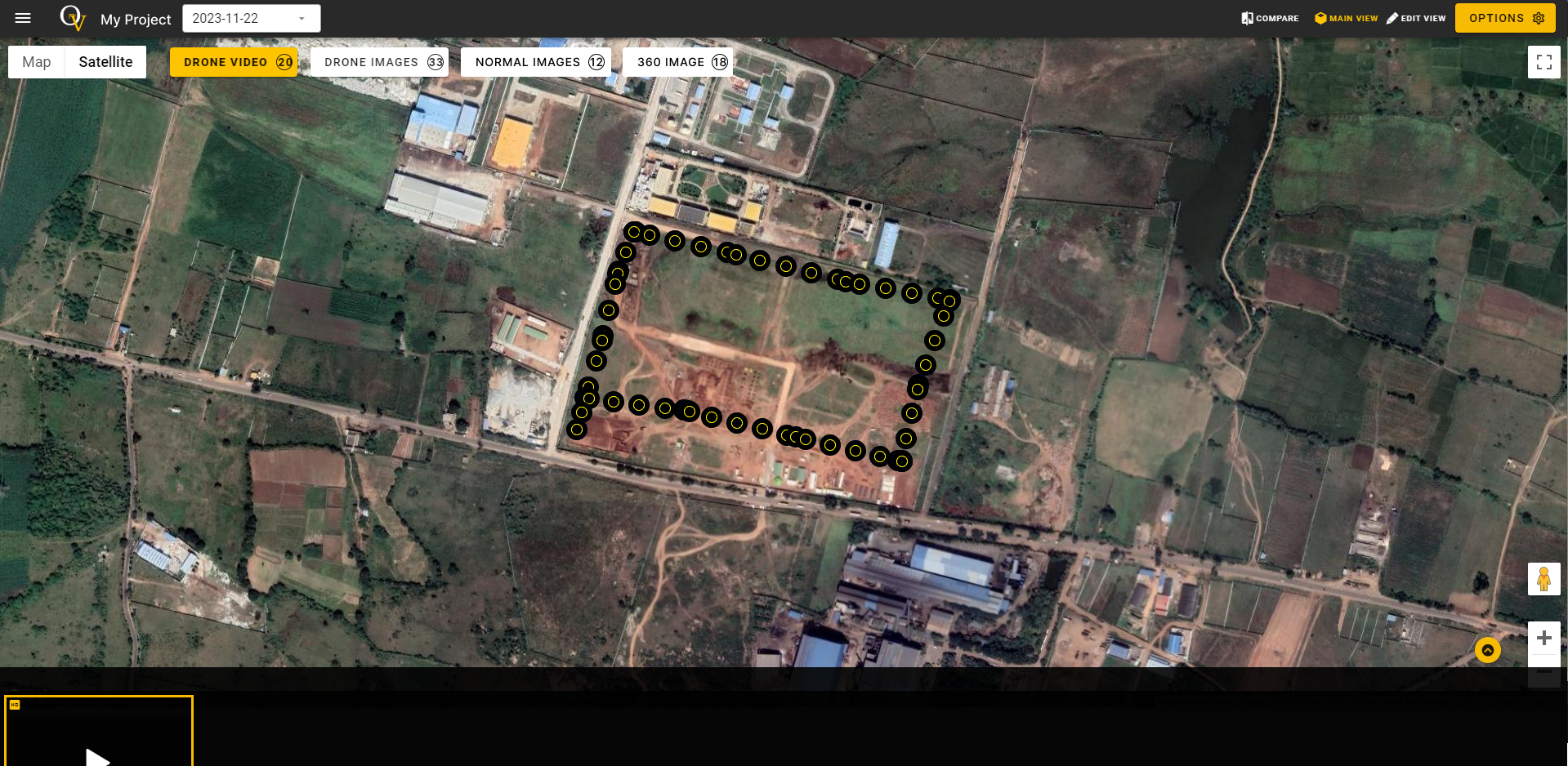
The construction drone's web dashboard allows effortless uploading of drone videos, 360-degree images, and regular drone images. Drone flyers can easily capture and upload various media files during any visit, ensuring the end user can make the most out of the available data.
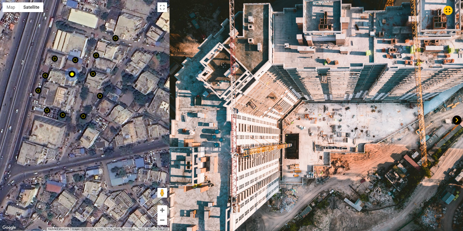
Construction drone-captured images and videos are mapped for easy location identification. Imagine the convenience of viewing a drone video on one half of the screen while its corresponding location is displayed on maps on the other half.
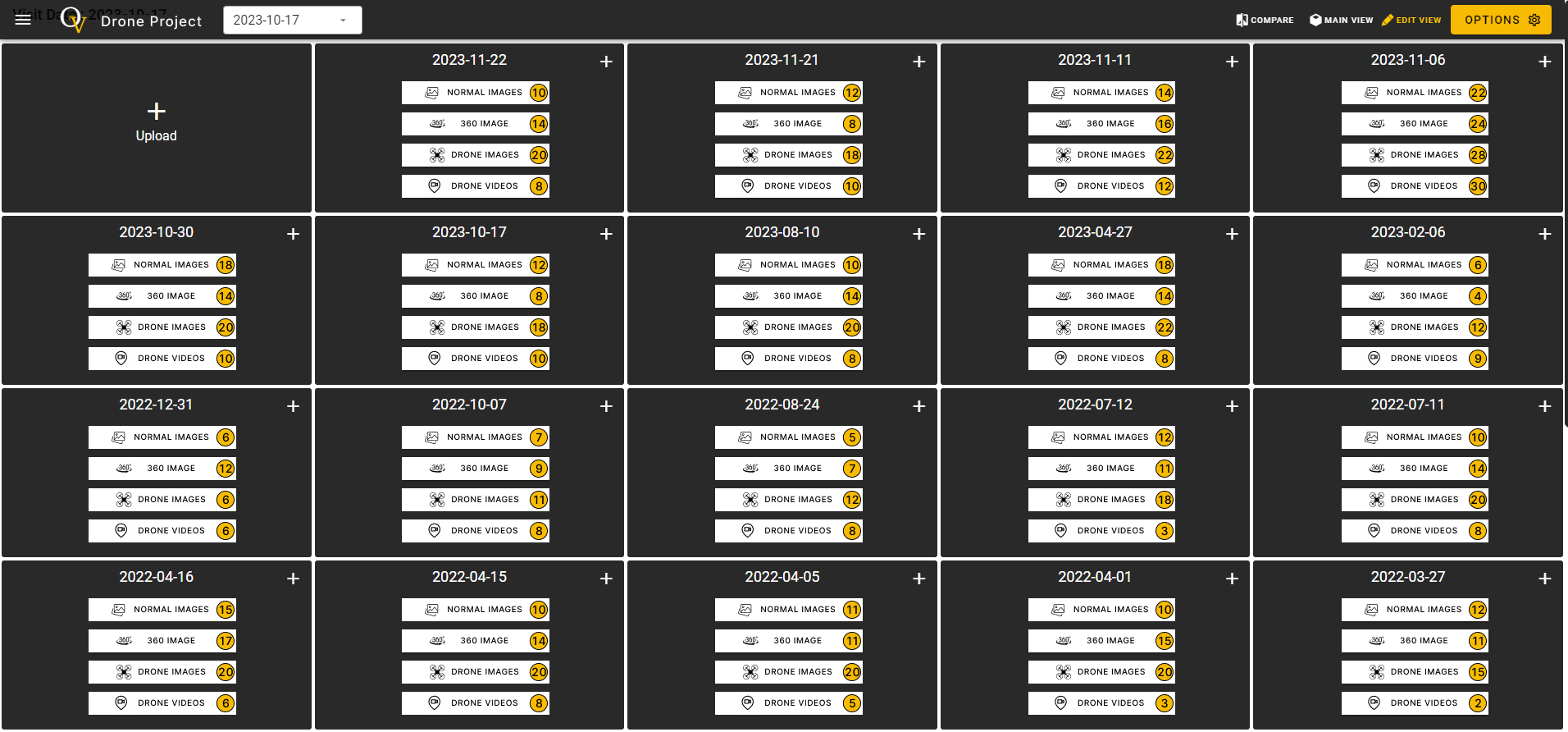
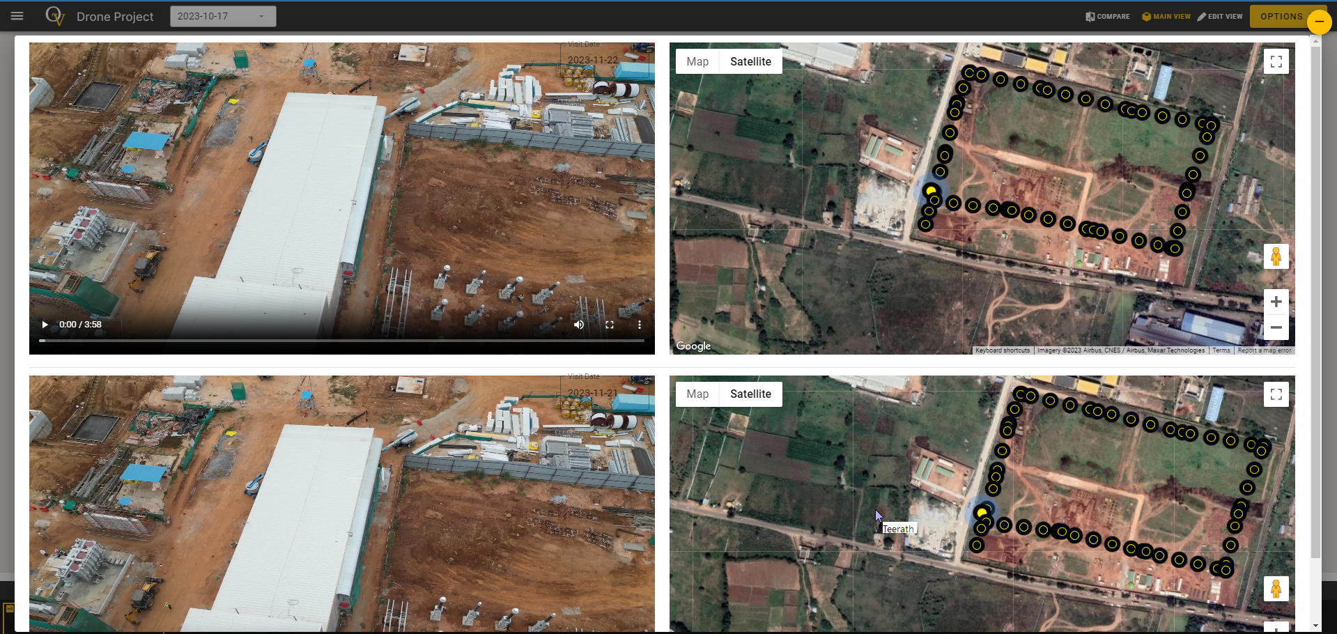
The construction drone data is neatly organized as per the drone flying date, allowing users to easily select any visit date and view videos, regular images, or 360-degree images. The data is securely stored on the cloud server from the initial flight to project completion.
Display important info while a drone video plays on the web-dashboard, making it easy to highlight key details without the need of video editing.
A waypoint is essentially a marked location along a route, serving as a reference point. In the realm of drones, waypoints facilitate automated flights by utilizing predefined points on the map, ensuring consistent path capture during multiple visits.

Our platform simplifies the process of comparing images and videos captured on different dates, offering a streamlined interface for a side-by-side analysis. This functionality empowers users to seamlessly juxtapose media files, allowing for a visual examination of changes, progress, and potential challenges encountered during various stages of the construction project.
| Construction Drones Benefits
Our construction drone service reigns supreme with crystal-clear aerial views, a streamlined cloud dashboard, and intuitive customization. Elevate your construction management and soar above the competition today!
Simplify project management with our construction drone cloud-based dashboard, ensuring seamless access to critical insights.
Elevate your perspective with high-resolution construction drone aerial footage, providing a clear and detailed view of your construction site.
Enjoy construction UAV solution that adapts to your needs, offering intuitive customization for reports, and monitoring parameters.
| Navigating Success
Your Future-Ready Solution for Precision, Efficiency, and Safety! Elevate Your Projects Today!
Get Started Now