Drones for Construction Progress Monitoring in India
Our construction drone monitoring offers basic images to 360° images and videos, geo-tagged visuals, waypoint capturing, image and video comparisons, and precise monitoring solutions.
Our construction drone monitoring offers basic images to 360° images and videos, geo-tagged visuals, waypoint capturing, image and video comparisons, and precise monitoring solutions.
A comprehensive drone solution designed specifically for construction site monitoring & tailored as per the client's requirement & usage.
Includes waypoint-based capturing of images, videos & 360° images using DJI drones. This includes drone data comparison over time, PDF reports generation, and sharing.
Various Data Type Support
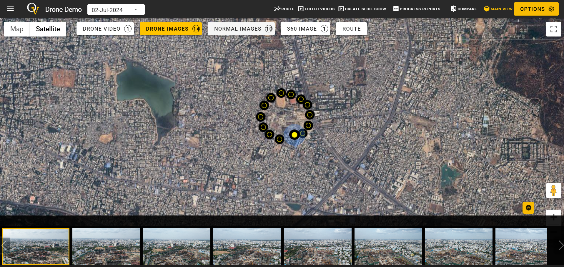
The construction drone's web dashboard allows effortless uploading of drone videos, 360-degree images, and regular drone images. Drone flyers can easily capture and upload various media files during any visit, ensuring the end user can make the most out of the available data.
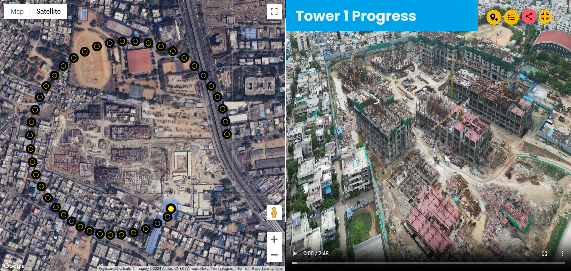
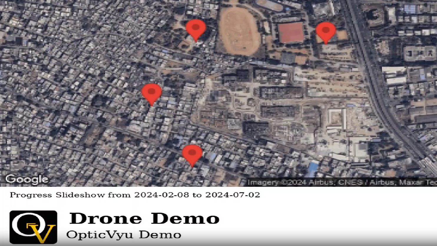
Geo-Tagged Data
Construction drone-captured images and videos are mapped for easy location identification. Imagine the convenience of viewing a drone video on one half of the screen while its corresponding location is displayed on maps on the other half.
Documented Drone Data
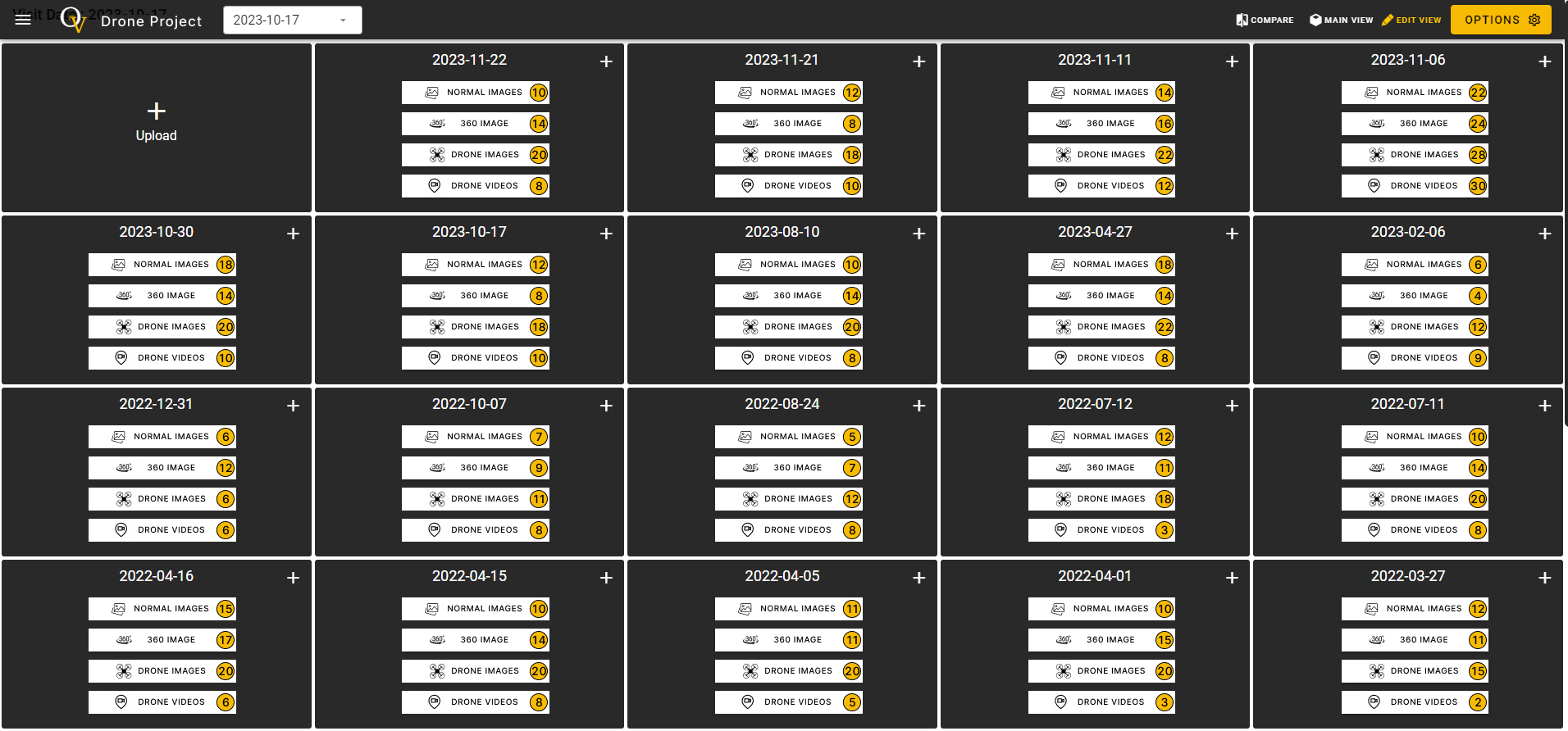
The construction drone data is neatly organized as per the drone flying date, allowing users to easily select any visit date and view videos, regular images, or 360-degree images. The data is securely stored on the cloud server from the initial flight to project completion.
Information Overlay
Display important info while a drone video plays on the web-dashboard, making it easy to highlight key details without the need of video editing.
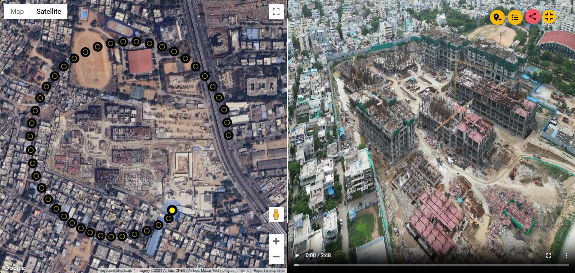
Waypoints Capturing
A waypoint is essentially a marked location along a route, serving as a reference point. In the realm of drones, waypoints facilitate automated flights by utilizing predefined points on the map, ensuring consistent path capture during multiple visits.
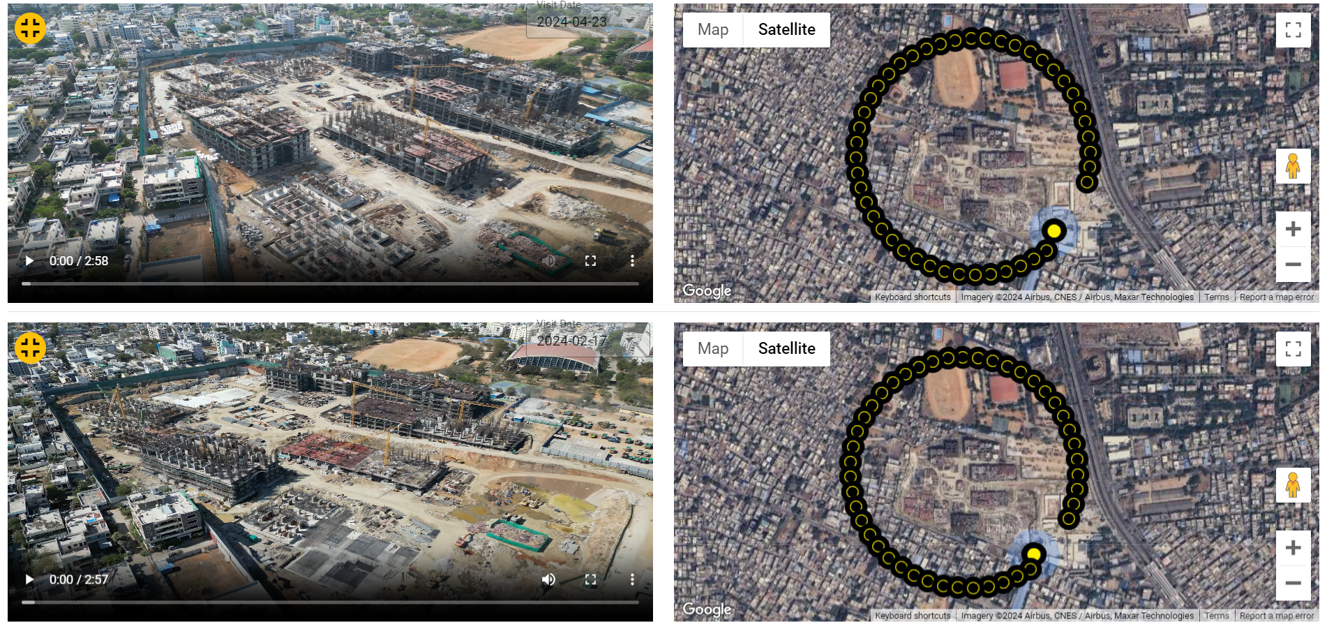
Progress Evaluation
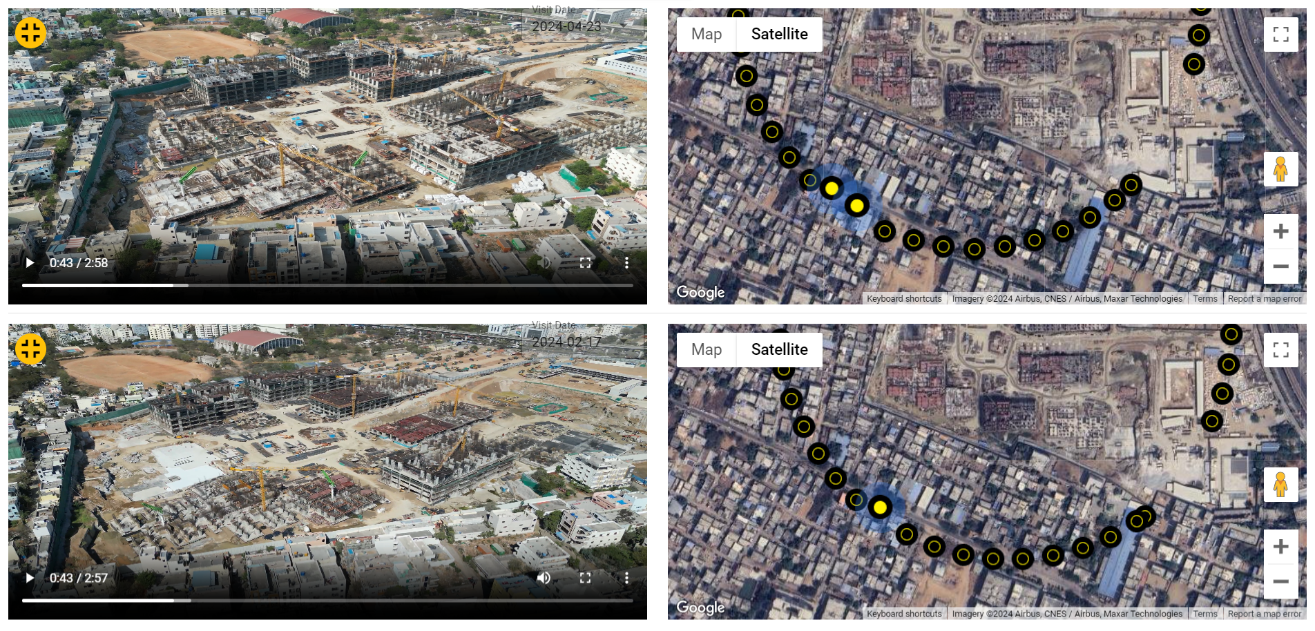
Our platform simplifies the process of comparing images and videos captured on different dates, offering a streamlined interface for a side-by-side analysis. This functionality empowers users to seamlessly juxtapose media files, allowing for a visual examination of changes, progress, and potential challenges encountered during various stages of the construction project.
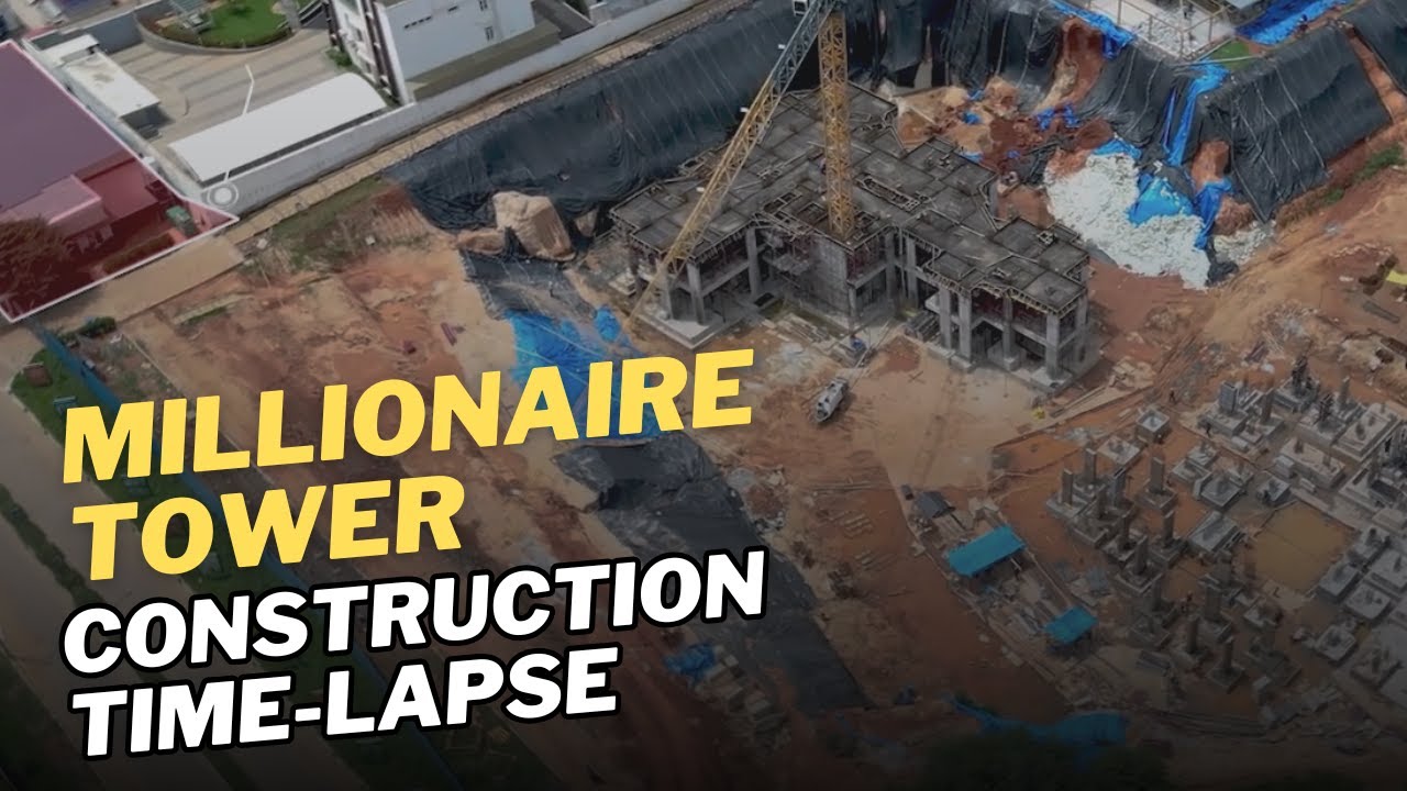
Slideshow Report
A better way to present the site progress in terms of a quick slideshow video. Users can generate slideshow videos of images for the selected points. The slideshow can be created by selecting 1, 2, or 4 points.
Progress Reports
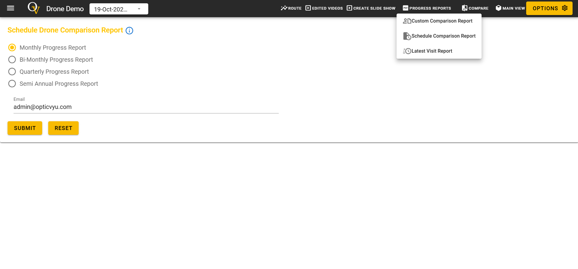
With our construction drone monitoring dashboard, you can create two types of reports Custom Comparison Report and Latest Visit Report. You can also schedule comparison report generation for monthly, bi-monthly, quarterly, and semi-annual intervals.
Instant Alerts
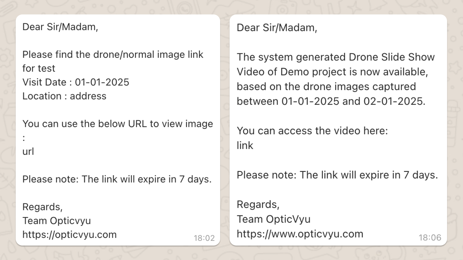
Get instant notifications whenever new drone-captured site visuals, PDF reports, slideshow videos, or video comparison reports are available. Access all files securely via download links valid for 7 days, keeping you fully informed on project progress.
| OpticVyu Construction Drones Benefits
OpticVyu's construction drone solution provides ultra-clear aerial imagery and a powerful cloud-based dashboard for real-time data access.
Simplify project management with our cloud-based dashboard, ensuring seamless access to critical construction insights.
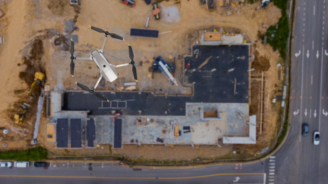
Elevate your perspective with high-resolution aerial footage, providing a clear and detailed view of your construction site.
Our construction UAV solution delivers geo-tagged visuals, waypoint capturing, data overlays, and real-time progress tracking, customized to meet your project requirements.
| Navigating Success